Hiking Asama Onsen – Part 1: No-Name-yama
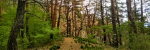
A few kilometers north of Matsumoto Castle, where the Metoba River valley begins to narrow, lies the quiet but well-known hot spring village of Asama Onsen. The part of Asama closer to the river consists mainly of narrow streets lined with the character of most any small Japanese town. As the roads incline toward the nearby mountains they become crowded with traditional Japanese hot spring inns that lend this community its flavor and draw thousands of visitors every year.
Some people are content to stop there. Others venture beyond, into the hills, on trails that require only a moderate amount of sweat while (usually) offering broad views of the Northern Alps. Mixing in some subtle bits of history makes the legwork eminently worthwhile.
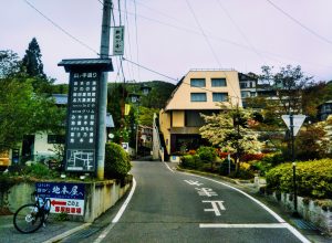
Hiking up either Daionji-yama or Goten-yama wins you panoramic views of the mountains, from flat-topped Ariake all the way down to the peaks of the Kiso Valley. Following the Sakura-ga-oka trail will bring you to a nameless peak higher than either Daionji or Goten, albeit one that is heavily forested. This trail, though offering only glimpses of the northern Alps through the trees, comes with its own character and quiet legacy, bringing us along a path walked by the people of this region since the Edo Era.
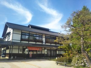
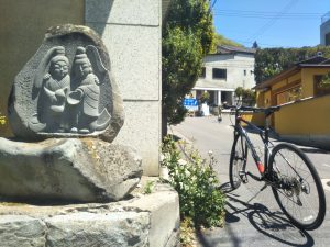
From the bus stop on the north side of Hot Plaza, Asama Onsen’s large public hot spring, it’s a short walk to the Sakura-ga-oka trail. Walk to the road running along the south side of Hot Plaza, and head toward the hills. If you pass this stone Dosojin statue you are on the right track. Just beyond this bear right where the road splits and look for the Sakura Hill sign on your right. From the bus stop to here is just a half mile.
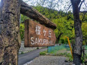
Once the pavement running toward Sakura-ga-oka ends it’s easy to get the impression you’re walking through someone’s garden. This place is actually a firefly farm of sorts, with small winding streams on either side of the path built specifically to attract fireflies in June. At the far end of the firefly farm on your left take a drink of the spring water flowing from the pipe. Then make your way up and through the gate. (Be nice and replace the chain!)
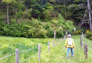
Following a fence for a short stretch, the trail doesn’t make a huge first impression. But soon enough you’re in the woods, walking along a path that the folks around here have been using for a few hundred years. People used to come up here to gather wood and hunt wild boar. Now it’s a simple and serene venture up into a forest of red pine.
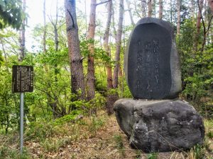
Before long you’ll come to this big stone monument. The sign, only in Japanese, explains:
Ito Sachio was a poet who wrote children’s verses in the late 19th and early 20th Centuries. He was a student of Masaoka Shiki, one of Japan’s four great poets, and in 1908 established a magazine called Araragi dedicated to the publication and promotion of tanka poetry. The poem etched in the stone, composed in the 42nd year of the Meiji Era (1909) and inscribed in the rock in the 15th year of the Showa Era (1940) talks of the rains that fall on the highlands of Norikura when the autumn breeze blows across Asama.
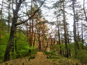
The trail up this unnamed mountain is steep in parts, and is in many places covered in fallen pine needles. These needles contain an oily substance that tends to make the needles slippery underfoot. Take care on your way up. Take extra care on your way down.
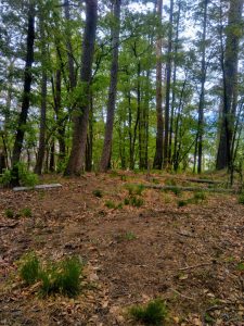
On your way up you’ll likely see evidence of logging. This is due to a recent spate of tree-killing insects doing their naughty thing. Also lying dead on the forested slopes are fallen trees that have been left to rot, fertilizing the soil and helping produce some brilliant spring and summer greens.
At the top of this mountain – though it may not seem like the top as the trail continues onward and upward – there is a triangular shelter of sorts, wooden posts and a blue tarp overlaid with branches for a roof. Believe it or not this is a Shinto shrine, the giveaway being the torii gate that, to be fair, looks about to fall over and start feeding the forest.
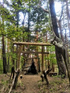
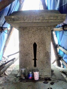
Under the tarp and straw is a stone shrine that looks like no other shrine I’ve ever seen. It is small and simple and has a hole cut into it that looks everything like a sword, one of three sacred funerary objects according to Shinto tradition. The openings to the shrine’s unusual roof point north and south. This is because the winds blow up from the west, and the roof, positioned as it is, lends protection not only to the shrine but to the people who over the centuries have used this shrine to rest, out of reach of the elements.
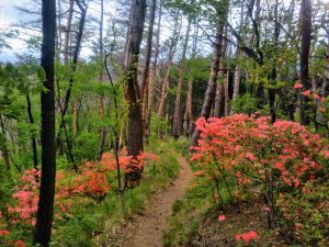
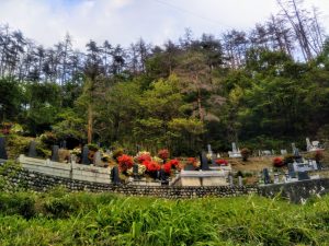
If you are feeling adventurous or energetic or both you can extend your hike around the mountain, either by continuing along the trail running past the shrine up to Lake Misuzuko or by taking the path that runs directly away from the wooden shrine gate. This trail winds downward through more red pine forest – and in certain months through some fantastic blooming azaleas – and down to the scant remnants of a set of three burial mounds called the Myogiyama Kofun.
The Myogiyama (“Mystery Mountain”) Tumulus Group consists of three burial mounds, discovered in 1950 and excavated five years later. Within the first burial mound were only remnants of stone walls and earthenware fragments. The second burial mound, to the north of the first, revealed skeletal remains, metal rings, spherical objects called tama, and a sword. Bone fragments were also excavated from the third burial mound to the south. In addition, the shrine of Myogiyama Jinja stood in this place until the end of the Meiji era.
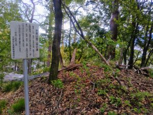
Disclaimer: After 1,500 years there isn’t much here anymore.
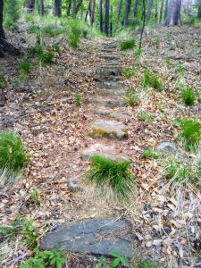
Burial mounds have been discovered all over, from this Shinshu area to the Nara and Osaka regions. A significant aspect of Shinto tradition beginning in the 3rd Century, the practice of building these kofun died out in the 7th Century when Buddhism was imported from the Asian mainland.
Matsumoto does have a few kofun scattered around. One of them, Koboyama, is the largest in the area. Check it out in this post.
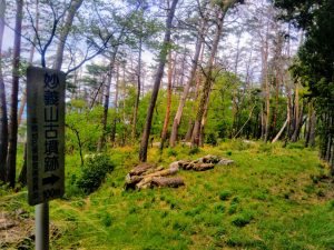
From the blue and white sign pointing toward these burial mounds there is a trail leading downhill (to your right if you are facing the same direction as in the picture above). Unfortunately, this will not take you back to where you started. Instead you’ll end up standing on a (probably) unfamiliar street between a baseball stadium and a Jehovah’s Witnesses place of some sort. Still, you are only a ten-minute walk from the Hot Plaza where you can soak your bones in a hot spring or simply catch the bus back to downtown Matsumoto.
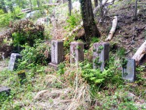
If you’d rather not try to make your way back to Hot Plaza this way, go back up the trail to that tent-shaped shrine and backtrack to the firefly farm. From there, if you haven’t yet had your fill of walking, you could go tackle Daionji or Goten-yama for those sweeping views of the northern Alps – along with a little more of the history that Asama Onsen has to offer.
** Just four kilometers from Matsumoto Castle, Asama Onsen is easily reachable by bicycle and a quick ride by bus. For information on both head for the visitor information center in the train station, or the one just south of the main entrance to the castle, and get the latest timetable.
** From Asama Onsen’s Hot Plaza, the trail (and the firefly farm, Hotaru no Sato) is up the road leading east. The trail ends near the baseball stadium and the Jehovah’s Witnesses place to the south.
[googlemaps https://www.google.com/maps/embed?pb=!1m14!1m8!1m3!1d1608.5200095315497!2d137.988285439534!3d36.26280734965177!3m2!1i1024!2i768!4f13.1!3m3!1m2!1s0x601d0c1a27f85663%3A0x450e6756bcfd92e5!2z5rWF6ZaT5rip5rOJ!5e0!3m2!1sen!2sjp!4v1589378502418!5m2!1sen!2sjp&w=600&h=450]