Hayashi Castle Ruins Hike in Iriyamabe

We all know the super famous Matsumoto Castle, but did you know that long before Matsumoto Castle was built that there were several castles built on the mountains that surround Matsumoto? (Here you can see a basic map of the major castle locations). Unfortunately, they are mostly in ruins or only barely recognizable by a bump in the earth, but for a couple of the castles you can still see large parts of the stonewalls and climb around on the ruins. I don’t know about you, but I love to explore old ruins like that and imagine what it was like when the castles were actually still in commission!
So, a couple of weeks ago I discovered the Hayashi Castle hiking trail in the Yamabe area where you can not only walk through a beautiful forest trail, but you also get to see the ruins of two castles along the way. The trail only takes 2 to 3 hours to complete so it’s a perfect way to get in some light hiking in the morning or afternoon.

For just a bit of history, Hayashi Castle actually consists of two separate castles located on two separate, but nearby mountains. They were built sometime around the 15th century by Ogasawara clan which governed the Shinano Province, but it was taken over by Takeda Shingen in the battle of Shiojiri Pass in 1548. There is an excellent overview of the history here for those who want to know more.
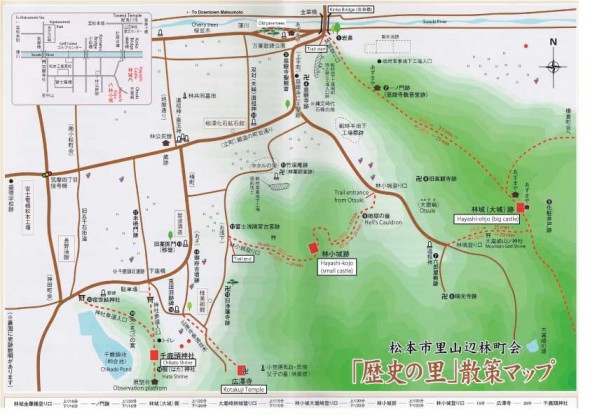
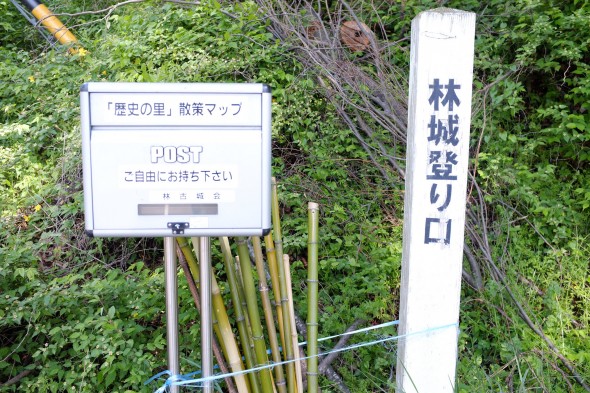
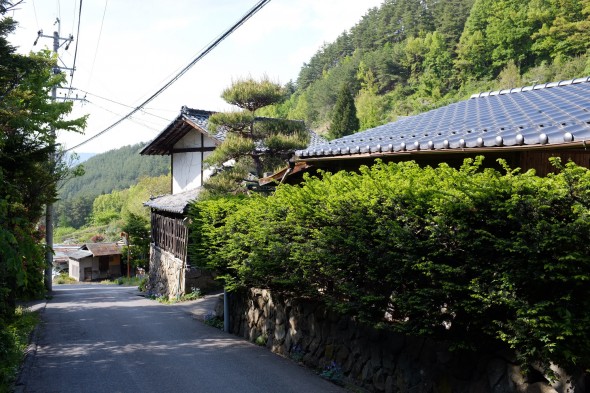
There are a couple of entrances to the trail, but the easiest one to find and start at is located right at the base of the mountain at the start of the Iriyamabe area along the Susuki River. It’s marked with a fairly large sign written in Japanese and you’ll find a supply of bamboo hiking sticks that are free to use, as well as a box that contains a map of the trail (assuming they haven’t run out). (I added English translations to the original map to mark the most important points. Click here to see or download)
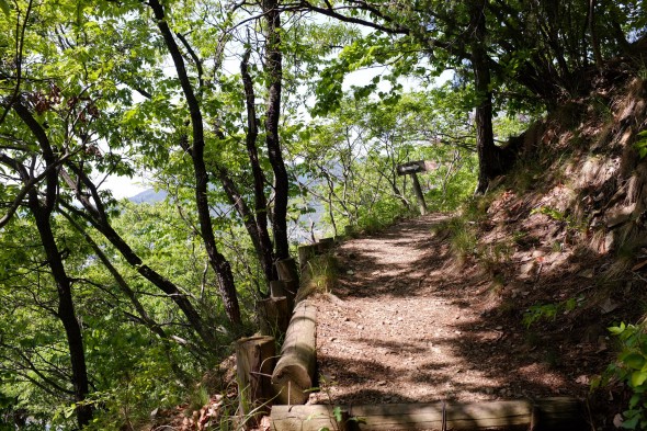
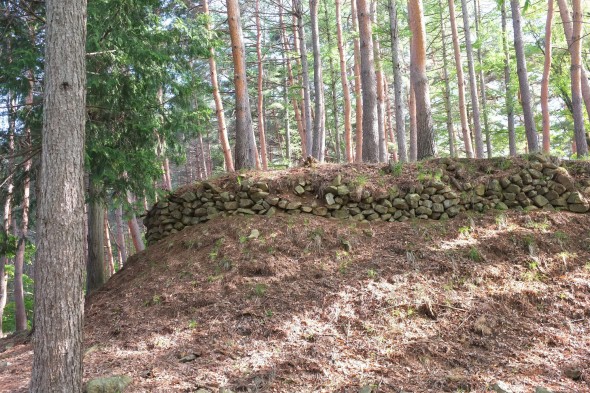
Right off the bat, you’ll have to climb up a steep slope for several minutes, but you’ll be rewarded with a great panoramic view of Matsumoto and the Japan Alps along the way. After hiking through a nice pine forest and reaching the top of the mountain, you’ll find the first castle ruins – Hayashi-Ojo (林城(大城), lit. big Hayashi Castle). The basic earthworks and some of the stonewalls are still there, and you’ll find some round stones that have a square carved out of them (I think maybe some kind of post support? See photo).
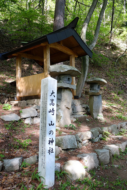
After that, follow the signs toward Hayashi-Kojo (林小城) and Otsuki (大嵩崎), heading back down the mountain on the other side, where you’ll spot a small “Otsuki Mountain God” shrine before coming out into the small village (called Otsuki). If you check the little altar of the shrine, there will probably be some offerings of snacks and/or sake placed there.


You’ll walk down the road through the village for a few minutes, keep an eye out for the old metal fire bell that’s hanging from a wooden post along the road. Then look for the sign that points to where the trail continues. Basically you have to turn left into what looks like a road into the fields, but at the foot of the mountain there you’ll see a big fence and gate. This is where the trail continues. It’s okay to open the gate and enter, just make sure you close it properly. Inside the gate and just as you enter the forest, you see one of my favorite spots on the the trail – “Jigoku no Kama” or “Hell’s Cauldron.” This is basically a sinkhole of some sort and on the sign it reads that no one knows if it’s natural or man-made, but apparently a horse got trapped in the sinkhole and died sometime in the past. Or as my colleague theorizes, perhaps it was some kind of trap or protection for guarding the castle!


After passing Hell’s Cauldron (don’t fall in!), you’ll trek up the second mountain to reach the second castle, Hayashi-kojo (林小城, lit. small Hayashi Castle). This castle is somewhat smaller, but the castles walls and shape are more prominent than the first one. You can see the basic outline/form of the castle and climb around on the top. It wouldn’t be a bad place for a picnic, as you can see a good view of Matsumoto through the trees from the top of the castle. After you’re done frolicking around on the castle, backtrack just a little bit to where there is a split in the trail at the foot of the castle, where there is a sign pointing toward Kotakuji Temple (廣澤寺). Follow the signs toward the temple until you reach the bottom of the mountain on the other side. Once you come out at the bottom (there’s another gate there), you can head back to where you started the trail to grab your bicycle or bus or walk back down the river to the city. (Of course you can optionally visit the temple too, though it’s in the opposite direction).


Access:
The closest bus stop is Satoyamabe Shutchojo on the Iriyamabe Line. However, the bus runs quite infrequently so you will need to plan well, or even better, use a bicycle. Just ride up the Susuki River until you reach the foot of the mountain. You could even walk from Matsumoto Station in about one hour. There will be a sign marking the start of the trail across the bridge at the edge of the trees. You can also park along the river in some places if you have a car.
See on Google Maps
Trail Map:
I added some English to the original Japanese map to mark the most important spots on the trail. See the PDF below:
Hayashi Castle Ruins Trail Map with English (PDF)